
Corner Inlet Fishing Location Map B (Laminated)
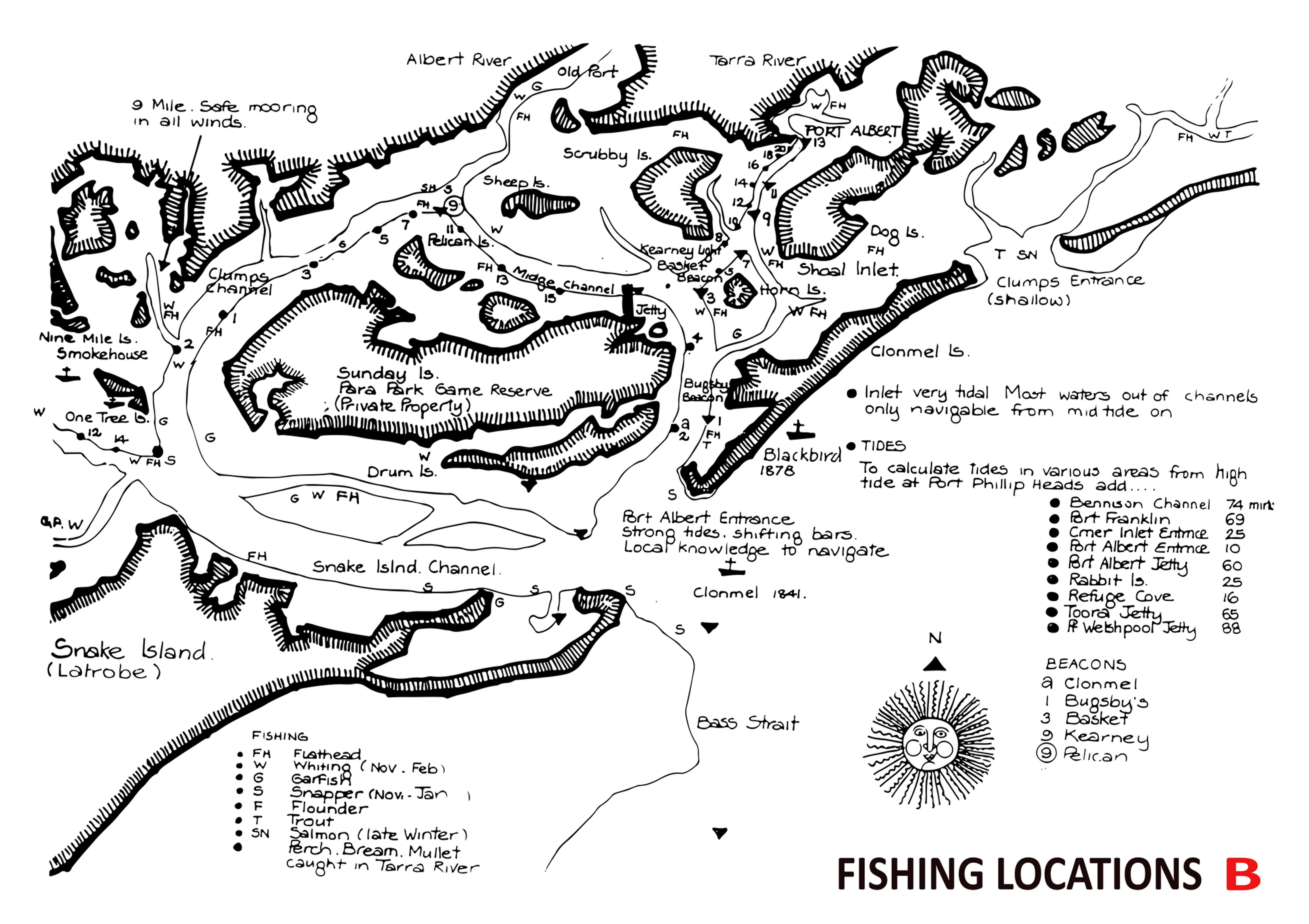
Explore the fishing grounds of Corner Inlet with this unique laminated fishing location map produced by the Port Albert Fishing Club.
Rich in local history and practical detail, this map is both a valuable on-water reference and a piece of the region’s fishing heritage.
The map was originally traced from historic nautical charts and carefully hand-drawn onto parchment during the commercial fishing era, likely in the 1960s.
It was later included in a rare publication describing the inlet and its fishing grounds, of which only one known copy still exists today. Importantly, the map captures many of the traditional and colloquial names used by generations of local fishers across Corner Inlet.
Reproduced and preserved by the club, this map allows today’s anglers to connect with the history of the area while navigating its productive fishing locations.
Product Features
Historic fishing location map of Corner Inlet
Originally traced from vintage nautical charts and hand-drawn in the 1960s
Includes many traditional and colloquial fishing location names
Fully laminated for durability in marine conditions
Ideal for use on the boat or as a keepsake for anglers.
Available Sizes
A4 Laminated Map $10.00 ea
A2 Laminated Map $30.00 ea
Fully laminated for durability, it’s ideal for use on the boat, helping you keep track of local fishing spots while out on the water.
)